Zoom
 Pan
Pan
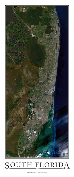
South Florida Wall Map
In Stock
by Outlook Maps
This satellite map offers a high resolution aerial view of South Florida taken from NASA satellites. The entire South Florida (Miami) metropolitan area is shown in the map, including all suburbs and communities.
The aerial image in the poster is extremely detailed. You'll be able to clearly see both manmade and natural features such as:
- Large buildings and skyscrapers
- Major roads and highways
- Airports
- Residential neighborhoods
- Parks, golf courses, zoos, sporting venues, amusement parks, etc.
- Rivers, lakes and ponds
- And Much More!
The Wall Map of South Florida is printed on 24lb. premium coated bond paper. It is also laminated on both sides using 3mm hot lamination, which protects your wall map and allows you to write on it with dry-erase markers.
Item Code: South Florida
Your Selection:
Size:
27 x 64"
Unit Price:
$83
Finishing Option:
Laminated
In Stock
Your Options
Available Map Sizes
Delivered as FAST as Next Day!


Available Finishing Options
27 x 64"
27 x 64"
Laminated Map
Selected
Select
Select
...with Wooden Rails
Select
Select
Select
...Mounted Maps
Select
Select
Select
...Magnetic Maps
Select
Select
Select
Looking for other Finishing Options?
ReStickersBasic FramedExec. FramedPlastic RailsSynthetic Maps
Other Wall Map Finishing Options
ReStickers
Select
Select
Select
Unfinished
...Basic Framed
Select
Select
Select
Dark Oak
...Executive Framed
Select
Select
Select
...Plastic Rails
Select
Select
Select
Archival Paper
Select
Select
Select
Synthetic Maps
Select
Select
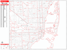
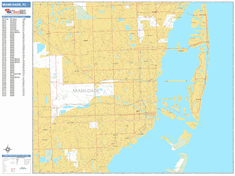
You might also like these City Wall Maps:
X
Item Successfully Added to Your Cart
South Florida Wall Map
$85.00
Outlook Maps
Qty: 1