Zoom
 Pan
Pan
Ohio Wall Map
In Stock
by MarketMAPS

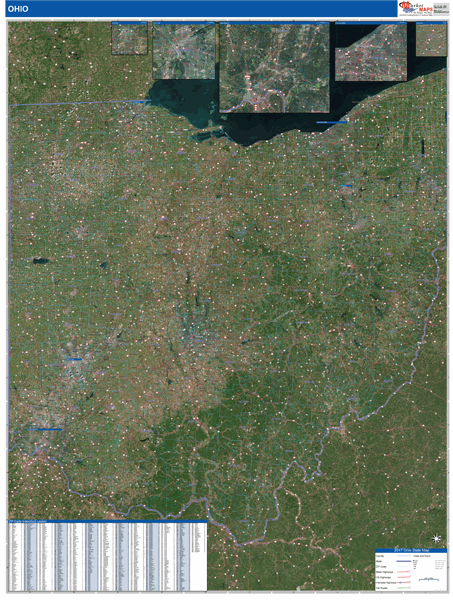
The Satellite ZIP Style Map is a detailed reference map. The Satellite ZIP Style Map is ideal for reference because it includes streets, highways and ZIP Codes. With this satellite map, you get a detailed reference map on a clear satellite image. This map comes laminated on both sides using 3mm hot lamination, which protects your wall map and allows you to write on it with dry-erase markers.
Your Selection:
Size:
36 x 48"
Unit Price:
$125
Finishing Option:
Laminated
In Stock
Your Options
Available Map Sizes
Delivered as FAST as Next Day!


Available Finishing Options

36 x 48"
48 x 64"
60 x 80"
72 x 96"
90 x 120"
108 x 144"
Laminated Map
Selected
Select
Select
Select
Select
Select
...with Wooden Rails
Select
Select
Select
Select
Select
Select
...Mounted Maps
Select
Select
Select
Select

...Magnetic Maps
Select
Select
Select
Select
Looking for other Finishing Options?
ReStickersBasic FramedExec. FramedPlastic RailsSynthetic Maps
Other Wall Map Finishing Options
ReStickers
Select
Select
Select
Unfinished
...Basic Framed
Select
Select
Select
Select
Dark Oak
...Executive Framed
Select
Select
Select
Select
...Plastic Rails
Select
Select
Select
Select
Select
Paper Maps
Select
Select
Select
Synthetic Maps
Select
Select
You might also like these Ohio Wall Maps:


X
Item Successfully Added to Your Cart
Ohio Wall Map
$85.00
Satellite ZIP Style 2026
MarketMAPS
Qty: 1