Zoom
 Pan
Pan
New Bedford
Metro Area, MA Zip Code Wall Map
In Stock
by MarketMAPS

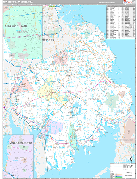
Zip Code New Bedford Wall Maps in the Premium Style contain an extensive amount of detail about the Metro Area. Zip Code information about New Bedford is conveniently displayed for easy reference and business use.
Customers prefer the Zip Code Premium Style so they can:
- - Visualize New Bedford, MA Zip Code numbers, indexes and coverage with ease.
- - Reference city streets, highways, and other locations in a convenient and precise manner.
- - Utilize unique and attractive displays for homes, offices and conference rooms.
- - Write on the laminated New Bedford Wall Map using dry erase markers.
In Stock
Choose Your
Wall Map
Wall Map
Choose Your
Map Sizes (inches)
Map Sizes (inches)
Delivered as FAST as Next Day!


Choose Your
Finishing Options
Finishing Options

36x48
48x64
60x80
72x96
90x120
108x144
Laminated Map
$125
add to cart
add to cart
$245
add to cart
add to cart
$375
add to cart
add to cart
$495
add to cart
add to cart
$745
add to cart
add to cart
$995
add to cart
add to cart
...with Wooden Rails
$175
add to cart
add to cart
$275
add to cart
add to cart
$495
add to cart
add to cart
$625
add to cart
add to cart
$995
add to cart
add to cart
$1195
add to cart
add to cart
...Mounted Maps
$375
add to cart
add to cart
$670
add to cart
add to cart
$945
add to cart
add to cart
$1120
add to cart
add to cart

...Magnetic Maps
$545
add to cart
add to cart
$870
add to cart
add to cart
$1195
add to cart
add to cart
$1620
add to cart
add to cart
Looking for other Finishing Options?
ReStickersBasic FramedExec. FramedPlastic RailsSynthetic Maps
Other Wall Map Finishing Options
ReStickers
$225
add to cart
add to cart
$325
add to cart
add to cart
$445
add to cart
add to cart
Unfinished
...Basic Framed
$425
add to cart
add to cart
$670
add to cart
add to cart
$995
add to cart
add to cart
$1220
add to cart
add to cart
Dark Oak
...Executive Framed
$545
add to cart
add to cart
$870
add to cart
add to cart
$1095
add to cart
add to cart
$1470
add to cart
add to cart
...Plastic Rails
$175
add to cart
add to cart
$275
add to cart
add to cart
$495
add to cart
add to cart
$625
add to cart
add to cart
$995
add to cart
add to cart
Paper Maps
$125
add to cart
add to cart
$245
add to cart
add to cart
$375
add to cart
add to cart
Synthetic Maps
$150
add to cart
add to cart
$295
add to cart
add to cart


X
Item Successfully Added to Your Cart
New Bedford Metro Area Zip Code
Wall Map $85.00
Wall Map $85.00
Premium Style 2026
MarketMAPS
Qty: 1