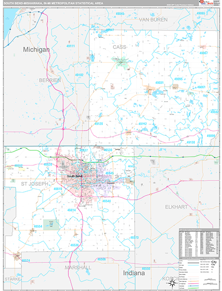
South Bend-Mishawaka
Metro Area, IN Wall Map
The Premium Style South Bend-Mishawaka Metro Area Wall Map is an attractive display with complete map detail. It is an ideal choice for applications that benefit from both a colorful display and full reference information. The Premium Style Wall Map of South Bend-Mishawaka Metro Area, Indiana features streets and highways with maximum streets based upon map size, as well as colorful shadings of populated places.
This South Bend-Mishawaka, Indiana wall map is laminated on both sides using 3mm hot lamination, which protects your map and allows you to write on it with dry-erase markers.


Wall Map $85.00
Premium Style 2026
MarketMAPS
Qty: 1