Little Rock-North Little Rock-Conway
Metro Area, AR Wall Map
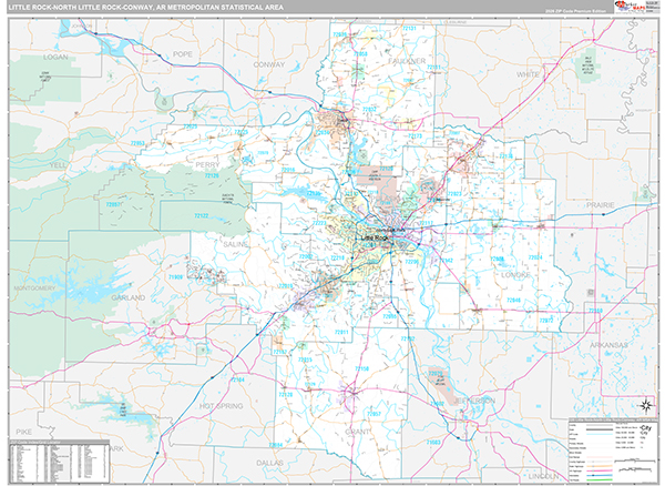
The Premium Style Little Rock-North Little Rock-Conway Metro Area Wall Map is an attractive display with complete map detail. It is an ideal choice for applications that benefit from both a colorful display and full reference information. The Premium Style Wall Map of Little Rock-North Little Rock-Conway Metro Area, Arkansas features streets and highways with maximum streets based upon map size, as well as colorful shadings of populated places.
This Little Rock-North Little Rock-Conway, Arkansas wall map is laminated on both sides using 3mm hot lamination, which protects your map and allows you to write on it with dry-erase markers.
Wall Map
Map Sizes (inches)


Finishing Options

add to cart
add to cart
add to cart
add to cart
add to cart
add to cart
add to cart
add to cart
add to cart
add to cart
add to cart
add to cart
add to cart
add to cart
add to cart
add to cart

add to cart
add to cart
add to cart
add to cart
add to cart
add to cart
add to cart
add to cart
add to cart
add to cart
add to cart
add to cart
add to cart
add to cart
add to cart
add to cart
add to cart
add to cart
add to cart
add to cart
add to cart
add to cart
add to cart
add to cart
add to cart


Metro Area Wall Map $85.00
Premium Style 2026
MarketMAPS
Qty: 1