Zoom
 Pan
Pan
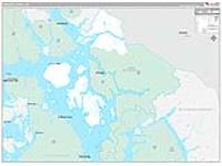
Wrangell-Petersburg Borough (County), AK
Demographic Wall Map
by MarketMAPS
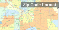
Current Year data displayed by 5-Digit ZIP Code
In Stock

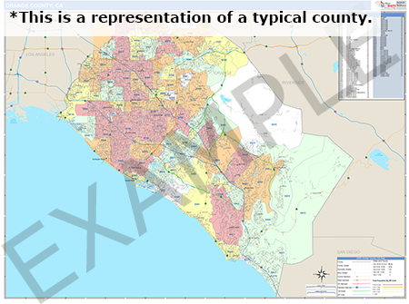
This Wrangell-Petersburg, AK Wall Map with Number of Households displays detailed reference information and demographic data. The Wrangell-Petersburg Demographic map shows the number of households by zip code with easy to read color shading. The map also displays commonly referenced information such as highways, major streets and cities.
People select this Wrangell-Petersburg Demographic Map because:
- - The information on the map is up-to-date and clear and easy-to-read.
- - The distinctive color shading makes it easy to identify the number of households per zip code across the entire Wrangell-Petersburg Borough (County)
- - They use the number of households to further understand their customers and the market area.
- - They write, draw and mark locations on the Wrangell-Petersburg demographic map using dry erase markers that are easily erasable on the laminated surface.
Need Help? Call a Map Specialist
1-888-434-6277
1-888-434-6277
In Stock
Choose Your
Wall Map
Wall Map
Choose Your
Map Sizes (inches)
Map Sizes (inches)
Delivered as FAST as Next Day!


Choose Your
Finishing Options
Finishing Options
36x48

48x64
60x80
72x96
90x120
108x144
Laminated Map
$175
add to cart
add to cart
$295
add to cart
add to cart
$425
add to cart
add to cart
$595
add to cart
add to cart
$845
add to cart
add to cart
$1095
add to cart
add to cart
...with Wooden Rails
$225
add to cart
add to cart
$325
add to cart
add to cart
$545
add to cart
add to cart
$725
add to cart
add to cart
$1095
add to cart
add to cart
$1295
add to cart
add to cart
...Mounted Maps
$375
add to cart
add to cart
$645
add to cart
add to cart
$895
add to cart
add to cart
$1095
add to cart
add to cart

...Magnetic Maps
$545
add to cart
add to cart
$845
add to cart
add to cart
$1145
add to cart
add to cart
$1595
add to cart
add to cart
Looking for other Finishing Options?
ReStickersBasic FramedExec. FramedPlastic RailsSynthetic Maps
Other Wall Map Finishing Options
ReStickers
$275
add to cart
add to cart
$375
add to cart
add to cart
$495
add to cart
add to cart
Unfinished
...Basic Framed
$425
add to cart
add to cart
$645
add to cart
add to cart
$945
add to cart
add to cart
$1195
add to cart
add to cart
Dark Oak
...Executive Framed
$545
add to cart
add to cart
$845
add to cart
add to cart
$1045
add to cart
add to cart
$1445
add to cart
add to cart
...Plastic Rails
$225
add to cart
add to cart
$325
add to cart
add to cart
$495
add to cart
add to cart
$695
add to cart
add to cart
$945
add to cart
add to cart
Paper Maps
$165
add to cart
add to cart
$275
add to cart
add to cart
$395
add to cart
add to cart
Synthetic Maps
$200
add to cart
add to cart
$300
add to cart
add to cart
You might also like this Wrangell-Petersburg (County), AK Wall Maps:
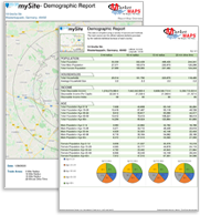
Demographic Reports
& Databases
& Databases
To learn more
Call Us Today
1-888-434-6277
Call Us Today
1-888-434-6277
X
Item Successfully Added to Your Cart
Wrangell-Petersburg Borough (County), AK Demographic Wall Map
$85.00
Basic Style 2026
MarketMAPS
Qty: 1