Highlands Ranch Zip Code Wall Map
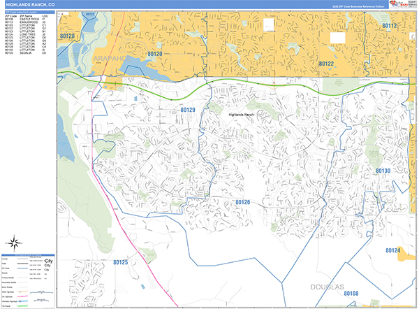
The Basic Style Highlands Ranch Wall Map is great for presentation, offering traditional colors with standard map detail. It is an excellent choice for applications that benefit from a professional look and basic map reference information. The Basic Style Wall Map of Highlands Ranch features streets and highways with maximum streets based upon map size, as well as color shadings of major populated areas.
This Highlands Ranch, Colorado wall map is laminated on both sides using 3mm hot lamination, which protects your map and allows you to write on it with dry-erase markers.
Wall Map
Map Sizes (inches)


Finishing Options

add to cart
add to cart
add to cart
add to cart
add to cart
add to cart
add to cart
add to cart
add to cart
add to cart
add to cart
add to cart
add to cart
add to cart
add to cart
add to cart

add to cart
add to cart
add to cart
add to cart
add to cart
add to cart
add to cart
add to cart
add to cart
add to cart
add to cart
add to cart
add to cart
add to cart
add to cart
add to cart
add to cart
add to cart
add to cart
add to cart
add to cart
add to cart
add to cart
add to cart
add to cart


Wall Map $85.00
Basic Style 2026
MarketMAPS
Qty: 1