Zoom
 Pan
Pan

Middle East Political Wall Map
In Stock
Maps International's Middle East wall map shows the whole of the Middle East area.
Middle East Map Details: This political wall map of the Middle East features countries marked in different colours, with international borders clearly shown. The map's key shows a panel of flags from each of the countries displayed in this Middle East map. This political wall map of the Middle East also contains population detail, capital cities and all the major towns and cities in this continent.
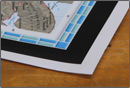
The Wall Map of Middle East Political is printed on 24lb. premium coated bond paper. It is also laminated on both sides using 3mm hot lamination, which protects your wall map and allows you to write on it with dry-erase markers.
Item Code: CT798_middleeast_pol_large
In Stock
Choose Your
Wall Map
Wall Map
Choose Your
Map Sizes (inches)
Map Sizes (inches)
Delivered as FAST as Next Day!


Choose Your
Finishing Options
Finishing Options
48x40
64x53
80x67
96x80
120x100
144x100
Laminated Map
$88
add to cart
add to cart
$118
add to cart
add to cart
$238
add to cart
add to cart
$363
add to cart
add to cart
$678
add to cart
add to cart
$763
add to cart
add to cart
...with Wooden Rails
$148
add to cart
add to cart
$198
add to cart
add to cart
$333
add to cart
add to cart
$648
add to cart
add to cart
$1323
add to cart
add to cart
$1683
add to cart
add to cart
...Mounted Maps
$578
add to cart
add to cart
$688
add to cart
add to cart
$1168
add to cart
add to cart
$1120
add to cart
add to cart

...Magnetic Maps
$658
add to cart
add to cart
$828
add to cart
add to cart
$1388
add to cart
add to cart
$1620
add to cart
add to cart
Looking for other Finishing Options?
ReStickersBasic FramedExec. FramedPlastic RailsSynthetic Maps
Other Wall Map Finishing Options
ReStickers
$225
add to cart
add to cart
$325
add to cart
add to cart
$445
add to cart
add to cart
Unfinished
...Basic Framed
$653
add to cart
add to cart
$783
add to cart
add to cart
$1288
add to cart
add to cart
$1220
add to cart
add to cart
Dark Oak
...Executive Framed
$713
add to cart
add to cart
$863
add to cart
add to cart
$1388
add to cart
add to cart
$1470
add to cart
add to cart
...Plastic Rails
$175
add to cart
add to cart
$275
add to cart
add to cart
$495
add to cart
add to cart
$625
add to cart
add to cart
$995
add to cart
add to cart
Paper Maps
$59
add to cart
add to cart
$93
add to cart
add to cart
$375
add to cart
add to cart
Synthetic Maps
$150
add to cart
add to cart
$295
add to cart
add to cart
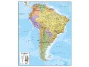
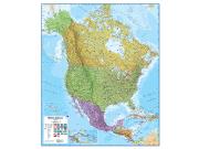
You might also like these Continent Wall Maps:
X
Item Successfully Added to Your Cart
Middle East Political
Wall Map $85.00
Wall Map $85.00
Lovell Johns
Qty: 1