MapSales.com - The leading source of wall maps

wall maps

Over 223,861 wall maps...
     
...delivered as FAST as Next Day!
1-888-434-6277
Contact Us here.
100% Satisfaction Guaranteed Free Shipping with FedEx & USPS!
Shop for Your Wall Maps
International Wall Maps
 
United States Wall Maps
 
Business Wall Maps
 
Wall Map Departments
 
Finishing Options
 
Our Publishers
How can we help?
 
Other Great Sites
Visit MarketMAPS.com
Visit ZipCodeMaps.com
Home > Continent Wall Maps > Europe Wall Maps > Europe Topography and Bathymetry Wall Map Newport Geographic

Europe Topography and Bathymetry Wall Map Newport Geographic

Europe Topography and Bathymetry Wall Map
Newport Geographic Continent Wall Map ZOOM In! with Cartoviewer
Choose Your

Wall Map
Choose Your
Map Size
Delivered as FAST as next day!
 
Choose Your
Finishing Options

36x46

48x61

60x76

72x91

90x114

108x136
Laminated Map
$85
add to cart
$125
add to cart
$225
add to cart
$395
add to cart
$495
add to cart
$655
add to cart
... with Wooden
Rails
$115
add to cart
$165
add to cart
$275
add to cart
$455
add to cart
$555
add to cart
$725
add to cart
... on Spring
Rollers
$145
add to cart
$185
add to cart
$305
add to cart
$495
add to cart
   
Mounted Map
$215
add to cart
$275
add to cart
$385
add to cart
$595
add to cart
   
Magnetic Map
$315
add to cart
$405
add to cart
$525
add to cart
$895
add to cart
   

Europe Topography and Bathymetry
Wall Map

by Newport Geographic
Newport Geographic Continent Wall Map

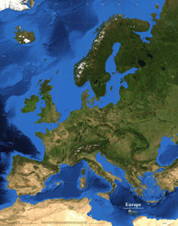
The European continent as seen from space with international borders and a 10° latitude and longitude grid, in Lambert Azimuthal Equal Area projection. It shows land cover and ocean bathymetry in brilliant color and in unparalleled detail as it appears in the month of August.

This satellite image map is the most accurate and up to date such map available today. The land imagery is based on data collected by NASA's MODIS satellite instrumentation in August 2004. Ocean bathymetry is derived from GEBCO (General Bathymetric Chart of the Oceans), 2003.

This view of the continent highlights the difference in climate and land cover from southern latitudes to northern latitudes.

This map is printed on 24lb. premium coated bond paper. It is also laminated on both sides using 3mm hot lamination, which protects your map and allows you to write on it with dry-erase markers.

Item Code: 4106-4_04P

You might also like these Wall Maps:

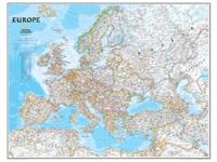
Europe
Wall Map

More Info
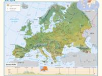
Europe
Physical
Wall Map

More Info
View Our Complete Selection of Europe Wall Maps!
 Return Policy | Legal Notice | About Us
 About Our Clients | Contact Us | Site Index | Help