| Home |
|
||||||||||||||||||||||||||||||||||||||||||||||||||||||||||||||||||||||||||||||||||||||||||||||||||||||||||||||||||||||||||||||||||||||||||||||||||||||||||||||||||

MarketMAPS publisher Wall Maps for you...At Work, At Home, At School!
MarketMAPS also has maps for every state, county, city, and metro area...as
well as US Regional area!
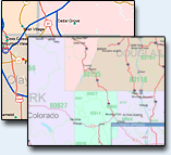
Choose the Map Style that's right for your Business use!
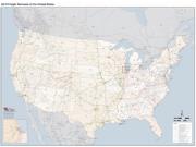
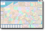
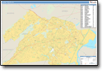
Premium
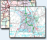
Attractive Display
Full map detail, Looks Great!
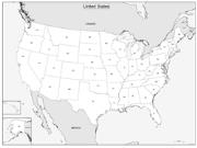
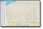
Basic
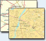
Basic Multi-Colored Map
Great presentation, easy-to-use.
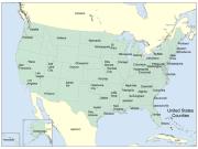
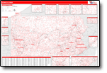
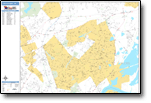
Color Cast
Traditional Colored Map
Each geographic area has its own color.
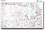
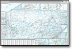
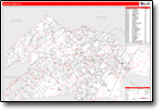
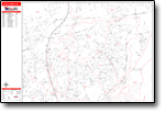
Red Line

Excellent Planning Tool
Easy-to-read-add your territories and locations... All Map Styles include:
- Index/Grid Locator
- Interstate/US/State Highways
- County Name/Boundaries
- Cities/Towns |
||||||||||||||||||||||||||||||||||||||||||||||||||||||||||||||||||||||||||||||||||||||||||||||||||||||||||||||||||||||||||||||||||||||||||||||||||||||||||||||||||
|
||||||||||||||||||||||||||||||||||||||||||||||||||||||||||||||||||||||||||||||||||||||||||||||||||||||||||||||||||||||||||||||||||||||||||||||||||||||||||||||||||