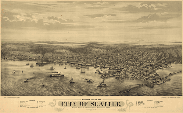
1878 Seattle Antique Wall Map
MapSales.com is proud to offer our collection of Antique Panoramic Wall Maps. Panoramic wall maps were very popular in the US and Canada in the late 19th and early 20th century. Cities are often portrayed from above with buildings and streets depicted at an oblique angle.
Our antique map of Seattle shows the city in 1878 from a bird's eye view. This map also includes the Pudget Sound, and the Washington Territory with points of interest indexed. This map is not drawn to scale.
The Wall Map of 1878 Seattle Antique is printed on 24lb. premium coated bond paper. It is also laminated on both sides using 3mm hot lamination, which protects your wall map and allows you to write on it with dry-erase markers.


MarketMAPS
Qty: 1